


descente claree

jmheydorff
User

Length
27 km

Max alt
2022 m

Uphill gradient
158 m
Km-Effort
31 km

Min alt
1356 m

Downhill gradient
819 m
Boucle
No
Creation date :
2025-08-04 08:45:24.677
Updated on :
2025-08-04 14:59:26.977
3h25
Difficulty : Very difficult

FREE GPS app for hiking
 SityTrail
IGN / Geographical institutes
SityTrail Plus
The world is yours!
About
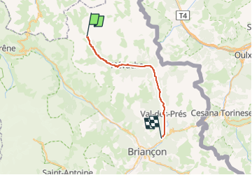
Trail Walking of 27 km to be discovered at Provence-Alpes-Côte d'Azur, Hautes-Alpes, Névache. This trail is proposed by jmheydorff.
Positioning
Country:
France
Region :
Provence-Alpes-Côte d'Azur
Department/Province :
Hautes-Alpes
Municipality :
Névache
Location:
Unknown
Start:(Dec)
Start:(UTM)
305217 ; 4992478 (32T) N.
Comments