


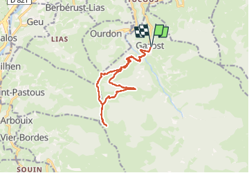
pic de hautacam depuis gazost

darancette
User

Length
15.1 km

Max alt
1738 m

Uphill gradient
1231 m
Km-Effort
32 km

Min alt
672 m

Downhill gradient
1231 m
Boucle
Yes
Creation date :
2025-08-04 07:42:54.856
Updated on :
2025-08-04 15:06:59.398
5h03
Difficulty : Medium

FREE GPS app for hiking
 SityTrail
IGN / Geographical institutes
SityTrail Plus
The world is yours!
About
Trail Walking of 15.1 km to be discovered at Occitania, Hautespyrenees, Gazost. This trail is proposed by darancette.
Positioning
Country:
France
Region :
Occitania
Department/Province :
Hautespyrenees
Municipality :
Gazost
Location:
Unknown
Start:(Dec)
Start:(UTM)
256269 ; 4768605 (31T) N.
Comments