


Circuit des lacs (Col de la Cayolle 04)

Clo0413
User
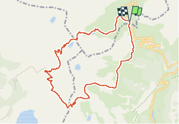

Length
11.3 km

Max alt
2648 m

Uphill gradient
628 m
Km-Effort
19.7 km

Min alt
2265 m

Downhill gradient
628 m
Boucle
Yes
Creation date :
2025-08-04 06:24:48.819
Updated on :
2025-08-04 16:11:46.84
3h40
Difficulty : Medium

FREE GPS app for hiking
 SityTrail
IGN / Geographical institutes
SityTrail Plus
The world is yours!
About
Trail Walking of 11.3 km to be discovered at Provence-Alpes-Côte d'Azur, Alpes-de-Haute-Provence, Uvernet-Fours. This trail is proposed by Clo0413.
Positioning
Country:
France
Region :
Provence-Alpes-Côte d'Azur
Department/Province :
Alpes-de-Haute-Provence
Municipality :
Uvernet-Fours
Location:
Unknown
Start:(Dec)
Start:(UTM)
319913 ; 4903193 (32T) N.
Comments