


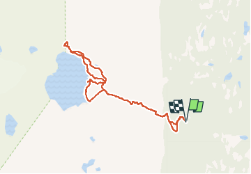
Rottenvik Vatnet

GOHIER
User

Length
9 km

Max alt
548 m

Uphill gradient
468 m
Km-Effort
15.3 km

Min alt
120 m

Downhill gradient
469 m
Boucle
Yes
Creation date :
2025-08-04 10:15:15.0
Updated on :
2025-08-04 17:12:23.499
6h05
Difficulty : Easy

FREE GPS app for hiking
 SityTrail
IGN / Geographical institutes
SityTrail Plus
The world is yours!
About
Trail Walking of 9 km to be discovered at Troms og Finnmark. This trail is proposed by GOHIER.
Description
Très beau après une raide montée. Vue sur les deux glaciers.
Positioning
Country:
Norway
Region :
Troms og Finnmark
Department/Province :
Unknown
Municipality :
Unknown
Location:
Unknown
Start:(Dec)
Start:(UTM)
471195 ; 7721835 (34W) N.
Comments