


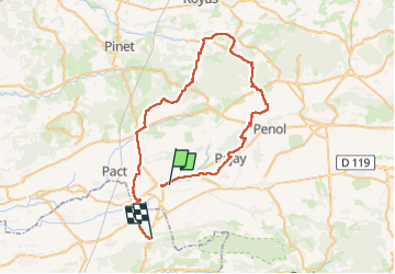
Villeneuve de marc

Vedett26
User

Length
59 km

Max alt
543 m

Uphill gradient
823 m
Km-Effort
70 km

Min alt
234 m

Downhill gradient
785 m
Boucle
No
Creation date :
2025-08-05 06:56:19.803
Updated on :
2025-08-05 11:24:43.989
4h27
Difficulty : Very difficult

FREE GPS app for hiking
 SityTrail
IGN / Geographical institutes
SityTrail Plus
The world is yours!
About
Trail Road bike of 59 km to be discovered at Auvergne-Rhône-Alpes, Isère, Beaurepaire. This trail is proposed by Vedett26.
Positioning
Country:
France
Region :
Auvergne-Rhône-Alpes
Department/Province :
Isère
Municipality :
Beaurepaire
Location:
Unknown
Start:(Dec)
Start:(UTM)
661702 ; 5022840 (31T) N.
Comments