


tour des beaux monts à Compiègne

jpaul77
User
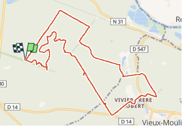

Length
13.3 km

Max alt
144 m

Uphill gradient
340 m
Km-Effort
17.9 km

Min alt
45 m

Downhill gradient
340 m
Boucle
Yes
Creation date :
2025-08-05 07:58:31.419
Updated on :
2025-08-05 13:37:50.832
5h38
Difficulty : Difficult

FREE GPS app for hiking
 SityTrail
IGN / Geographical institutes
SityTrail Plus
The world is yours!
About
Trail Walking of 13.3 km to be discovered at Hauts-de-France, Oise, Compiègne. This trail is proposed by jpaul77.
Description
très belle rando vallonnée avec des arbres centenaires
Positioning
Country:
France
Region :
Hauts-de-France
Department/Province :
Oise
Municipality :
Compiègne
Location:
Unknown
Start:(Dec)
Start:(UTM)
491491 ; 5472760 (31U) N.
Comments