


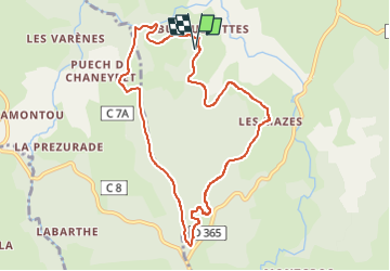
Les Burguerettes, le Lebot
© OpenStreetMap contributors


2h52
Difficulty : Easy


Length
9.4 km
Max alt
1027 m
Uphill gradient
246 m
Km-Effort
12.6 km
Min alt
856 m
Downhill gradient
245 m
Boucle
Yes
Creation date :
2025-08-06 08:02:41.097
Updated on :
2025-08-07 08:07:14.987
2h52
Difficulty : Easy
FREE GPS app for hiking
 SityTrail
IGN / Geographical institutes
SityTrail Plus
The world is yours!
About
Trail Walking of 9.4 km to be discovered at Auvergne-Rhône-Alpes, Cantal, Lieutadès. This trail is proposed by les joyeux randonneurs.
Positioning
Country:
France
Region :
Auvergne-Rhône-Alpes
Department/Province :
Cantal
Municipality :
Lieutadès
Location:
Unknown
Start:(Dec)
Start:(UTM)
490444 ; 4964132 (31T) N.
Comments