


gta jour 29

yvesconnes
User
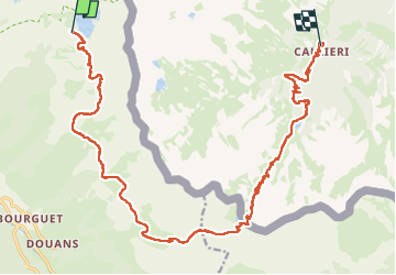

Length
23 km

Max alt
2711 m

Uphill gradient
701 m
Km-Effort
36 km

Min alt
1423 m

Downhill gradient
1781 m
Boucle
No
Creation date :
2025-08-06 06:21:39.375
Updated on :
2025-08-07 14:48:54.844
6h00
Difficulty : Difficult

FREE GPS app for hiking
 SityTrail
IGN / Geographical institutes
SityTrail Plus
The world is yours!
About
Trail Walking of 23 km to be discovered at Provence-Alpes-Côte d'Azur, Maritime Alps, Saint-Étienne-de-Tinée. This trail is proposed by yvesconnes.
Positioning
Country:
France
Region :
Provence-Alpes-Côte d'Azur
Department/Province :
Maritime Alps
Municipality :
Saint-Étienne-de-Tinée
Location:
Unknown
Start:(Dec)
Start:(UTM)
338636 ; 4903681 (32T) N.
Comments