


mm

JLRando
User
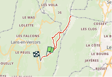

Length
10.8 km

Max alt
1885 m

Uphill gradient
454 m
Km-Effort
17.1 km

Min alt
1360 m

Downhill gradient
519 m
Boucle
No
Creation date :
2025-08-02 11:07:36.611
Updated on :
2025-08-10 10:06:25.706
3h24
Difficulty : Easy

FREE GPS app for hiking
 SityTrail
IGN / Geographical institutes
SityTrail Plus
The world is yours!
About
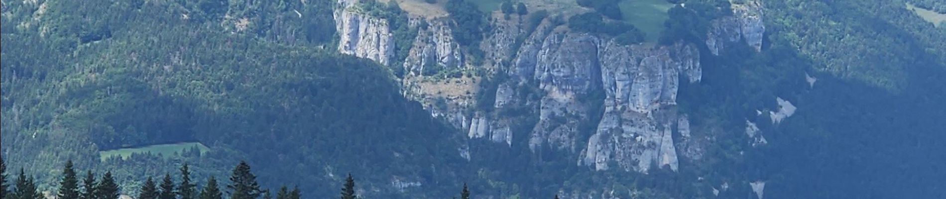
Trail Walking of 10.8 km to be discovered at Auvergne-Rhône-Alpes, Isère, Lans-en-Vercors. This trail is proposed by JLRando.
Photos


Positioning
Country:
France
Region :
Auvergne-Rhône-Alpes
Department/Province :
Isère
Municipality :
Lans-en-Vercors
Location:
Unknown
Start:(Dec)
Start:(UTM)
705437 ; 4999219 (31T) N.
Comments