


Crête des Glaisettes

edevuyst
User

Length
8.9 km

Max alt
2373 m

Uphill gradient
571 m
Km-Effort
16.6 km

Min alt
1808 m

Downhill gradient
581 m
Boucle
Yes
Creation date :
2025-08-10 09:51:03.0
Updated on :
2025-08-10 13:14:32.043
2h30
Difficulty : Medium

FREE GPS app for hiking
 SityTrail
IGN / Geographical institutes
SityTrail Plus
The world is yours!
About
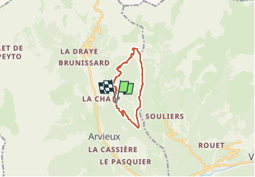
Trail Walking of 8.9 km to be discovered at Provence-Alpes-Côte d'Azur, Hautes-Alpes, Arvieux. This trail is proposed by edevuyst.
Positioning
Country:
France
Region :
Provence-Alpes-Côte d'Azur
Department/Province :
Hautes-Alpes
Municipality :
Arvieux
Location:
Unknown
Start:(Dec)
Start:(UTM)
321599 ; 4960912 (32T) N.
Comments