


gta jour 33

yvesconnes
User
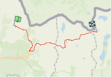

Length
15.3 km

Max alt
2826 m

Uphill gradient
1650 m
Km-Effort
36 km

Min alt
1863 m

Downhill gradient
1173 m
Boucle
No
Creation date :
2025-08-10 06:42:01.729
Updated on :
2025-08-12 16:07:43.489
7h25
Difficulty : Very difficult

FREE GPS app for hiking
 SityTrail
IGN / Geographical institutes
SityTrail Plus
The world is yours!
About
Trail Walking of 15.3 km to be discovered at Provence-Alpes-Côte d'Azur, Maritime Alps, Saint-Martin-Vésubie. This trail is proposed by yvesconnes.
Positioning
Country:
France
Region :
Provence-Alpes-Côte d'Azur
Department/Province :
Maritime Alps
Municipality :
Saint-Martin-Vésubie
Location:
Unknown
Start:(Dec)
Start:(UTM)
367092 ; 4886111 (32T) N.
Comments