


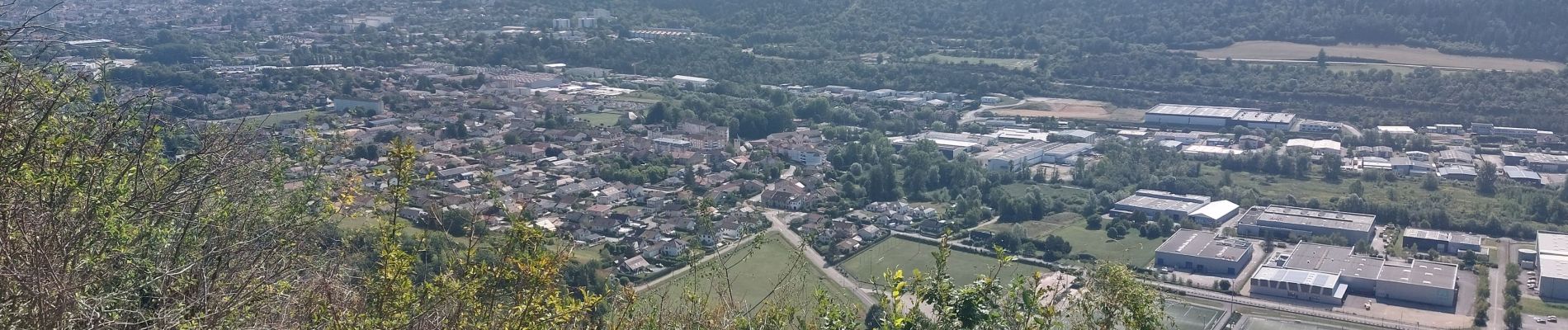
point de vue Golo par Geovreisset

cailloux54
User
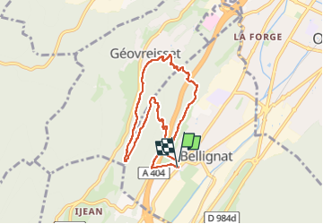

Length
7.3 km

Max alt
723 m

Uphill gradient
214 m
Km-Effort
10.2 km

Min alt
523 m

Downhill gradient
215 m
Boucle
Yes
Creation date :
2025-08-14 07:07:34.06
Updated on :
2025-08-14 10:27:49.086
1h58
Difficulty : Medium

FREE GPS app for hiking
 SityTrail
IGN / Geographical institutes
SityTrail Plus
The world is yours!
About
Trail Walking of 7.3 km to be discovered at Auvergne-Rhône-Alpes, Ain, Bellignat. This trail is proposed by cailloux54.
Photos


Positioning
Country:
France
Region :
Auvergne-Rhône-Alpes
Department/Province :
Ain
Municipality :
Bellignat
Location:
Unknown
Start:(Dec)
Start:(UTM)
702303 ; 5124185 (31T) N.
Comments