


Etrechy via villeneuve sur Auvers

reflexe
User
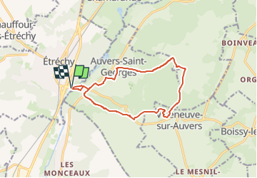

Length
12 km

Max alt
150 m

Uphill gradient
182 m
Km-Effort
14.4 km

Min alt
61 m

Downhill gradient
181 m
Boucle
Yes
Creation date :
2025-08-16 12:20:18.25
Updated on :
2025-08-16 12:29:38.316
3h16
Difficulty : Easy

FREE GPS app for hiking
 SityTrail
IGN / Geographical institutes
SityTrail Plus
The world is yours!
About
Trail On foot of 12 km to be discovered at Ile-de-France, Essonne, Étréchy. This trail is proposed by reflexe.
Description
boucle
Positioning
Country:
France
Region :
Ile-de-France
Department/Province :
Essonne
Municipality :
Étréchy
Location:
Unknown
Start:(Dec)
Start:(UTM)
440668 ; 5370484 (31U) N.
Comments