


Cime de la Condamine

pblois
User
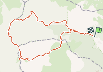

Length
13.4 km

Max alt
2936 m

Uphill gradient
1067 m
Km-Effort
28 km

Min alt
1867 m

Downhill gradient
1062 m
Boucle
Yes
Creation date :
2025-08-19 06:20:06.969
Updated on :
2025-08-20 10:20:55.919
6h41
Difficulty : Very difficult

FREE GPS app for hiking
 SityTrail
IGN / Geographical institutes
SityTrail Plus
The world is yours!
About
Trail Walking of 13.4 km to be discovered at Provence-Alpes-Côte d'Azur, Hautes-Alpes, Puy-Saint-André. This trail is proposed by pblois.
Positioning
Country:
France
Region :
Provence-Alpes-Côte d'Azur
Department/Province :
Hautes-Alpes
Municipality :
Puy-Saint-André
Location:
Unknown
Start:(Dec)
Start:(UTM)
308190 ; 4973886 (32T) N.
Comments