


chemin des estives

zazibelle
User
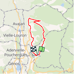

Length
11.6 km

Max alt
1725 m

Uphill gradient
569 m
Km-Effort
19.2 km

Min alt
1233 m

Downhill gradient
568 m
Boucle
Yes
Creation date :
2016-08-10 00:00:00.0
Updated on :
2016-08-10 00:00:00.0
3h25
Difficulty : Easy

FREE GPS app for hiking
 SityTrail
IGN / Geographical institutes
SityTrail Plus
The world is yours!
About
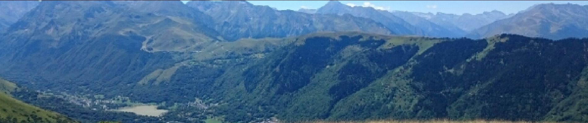
Trail Walking of 11.6 km to be discovered at Occitania, Hautespyrenees, Mont. This trail is proposed by zazibelle.
Photos


Positioning
Country:
France
Region :
Occitania
Department/Province :
Hautespyrenees
Municipality :
Mont
Location:
Unknown
Start:(Dec)
Start:(UTM)
289929 ; 4743566 (31T) N.
Comments