Trail Cycle Taussac - Tour des ruisseaux du Goul et de l'Embernat - Photo

Tour des ruisseaux du Goul et de l'Embernat

 destras
destras

User

© OpenStreetMap contributors
Length
Length
47 km
Max alt
Max alt
805 m
Uphill gradient
Uphill gradient
1037 m
Km-Effort
Km-Effort  
61 km
Min alt
Min alt
390 m
Downhill gradient
Downhill gradient
1037 m
Boucle
Boucle
Yes
Creation date :
2016-03-21 00:00:00.0
Updated on :
2016-03-21 00:00:00.0

(0 Reviews)

Cycle
Cycle
3h01
Difficulty : Difficult

Scan this QR Code to open this trail in the SityTrail application

FREE GPS app for hiking

Logo SityTrail SityTrail

IGN / Geographical institutes

Download SityTrail from the App Store Download SityTrail from Google Play

Logo SityTrail SityTrail World

The world is yours!

Download SityTrail from the App Store Download SityTrail from Google Play Download SityTrail on Huawei AppGallery

About

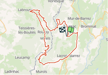
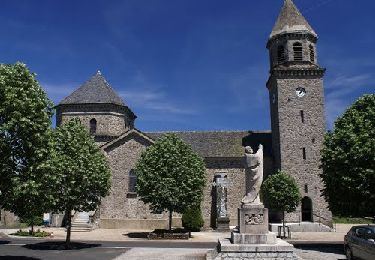
Trail Cycle of 47 km to be discovered at Occitania, Aveyron, Taussac. This trail is proposed by destras.

Description

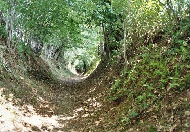
Départ du hameau de Masclat vers le pied du rocher de Ronesque (Bazaygues). Montée vers Vezel-Roussy par Labrousse puis descente vers Manhiaval. Grimpette difficile vers Murols-Soubeyre. Vous fermez la boucle par Lacroix-Barrez, c'est presque plat !

Elevation profile

Photos

Points of interest

Point of interest Taussac - Manhaval - Photo
destras
TAUSSAC 

Positioning

Country:
France
Region :
Occitania
Department/Province :
Aveyron
Municipality :
Taussac
Location:
Unknown
Start:(UTM)
471129 ; 4962147 (31T) N.

Trails nearby

Trail Walking Lacroix-Barrez - Chateau Vallon au depart de Bars  - Photo
Walking
tercla

Walking

Medium
Lacroix-Barrez, Occitania, Aveyron, France
19.2 km | 27 km-effort
6h 31min
Yes
Trail Sled dogs Cros-de-Ronesque - TDV-Ronesque-Pailherols - Photo
Sled dogs
randolibre

Sled dogs

Very easy
(1)
Cros-de-Ronesque, Auvergne-Rhône-Alpes, Cantal, France
20 km | 29 km-effort
Unknown
No
Trail Walking Taussac - Taussac vers le tour du rocher de Ronesque et retour - Photo
Walking
destras

Walking

Difficult
Taussac, Occitania, Aveyron, France
17.8 km | 28 km-effort
5h 10min
Yes
Trail Walking Taussac - Taussac le tour du ru de Combellou - Photo
Walking
destras

Walking

Medium
Taussac, Occitania, Aveyron, France
15 km | 21 km-effort
4h 28min
Yes
Trail Walking Taussac - la forêt magique - Photo
Walking
jimbono85

Walking

Easy
Taussac, Occitania, Aveyron, France
4.1 km | 6.1 km-effort
1h 28min
Yes
Trail Walking Taussac - Taussac vers Manhiaval, retour par Vezel - Photo
Walking
destras

Walking

Difficult
Taussac, Occitania, Aveyron, France
23 km | 34 km-effort
6h 30min
Yes
Trail Walking Lacroix-Barrez - Boucle Bars, château de Vallon, Fraysse  - Photo
Walking
destras

Walking

Medium
(1)
Lacroix-Barrez, Occitania, Aveyron, France
18.6 km | 27 km-effort
4h 58min
Yes
Trail Walking Taussac - le tour du ruisseau d'Embernat - Photo
Walking
destras

Walking

Medium
Taussac, Occitania, Aveyron, France
21 km | 27 km-effort
5h 48min
Yes
Trail On foot Mur-de-Barrez - liaison Thérondels - Mur-de-Barrez - Photo
On foot
PRO

On foot

Easy
Mur-de-Barrez, Occitania, Aveyron, France
3 km | 4 km-effort
54min
No


Close
My subscriptions