


bagan popa

mapomme
User

Length
95 km

Max alt
682 m

Uphill gradient
947 m
Km-Effort
106 km

Min alt
59 m

Downhill gradient
400 m
Boucle
No
Creation date :
2015-08-16 00:00:00.0
Updated on :
2015-08-16 00:00:00.0
28h02
Difficulty : Unknown

FREE GPS app for hiking
 SityTrail
IGN / Geographical institutes
SityTrail Plus
The world is yours!
About
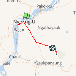
Trail Other activity of 95 km to be discovered at Mandalay, Nyaung-U District, Nyaung-U Township. This trail is proposed by mapomme.
Positioning
Country:
Myanmar
Region :
Mandalay
Department/Province :
Nyaung-U District
Municipality :
Nyaung-U Township
Location:
Unknown
Start:(Dec)
Start:(UTM)
696620 ; 2344493 (46Q) N.
Comments