Trail Walking Lascelle - Roman de Jordanne - Photo
© OpenStreetMap contributors
Length
Length
17.7 km
Max alt
Max alt
1095 m
Uphill gradient
Uphill gradient
675 m
Km-Effort
Km-Effort  
27 km
Min alt
Min alt
703 m
Downhill gradient
Downhill gradient
675 m
Boucle
Boucle
Yes
Creation date :
2015-08-27 00:00:00.0
Updated on :
2015-08-27 00:00:00.0

(1 Reviews)

Walking
Walking
5h54
Difficulty : Medium

Scan this QR Code to open this trail in the SityTrail application

FREE GPS app for hiking

Logo SityTrail SityTrail

IGN / Geographical institutes

Download SityTrail from the App Store Download SityTrail from Google Play

Logo SityTrail SityTrail World

The world is yours!

Download SityTrail from the App Store Download SityTrail from Google Play Download SityTrail on Huawei AppGallery

About

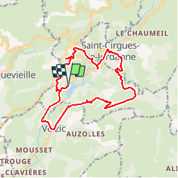
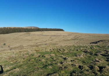
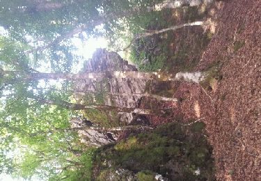
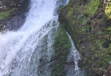
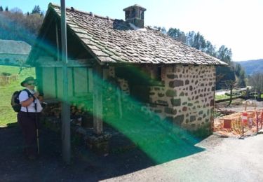
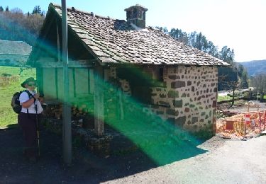
Trail Walking of 17.7 km to be discovered at Auvergne-Rhône-Alpes, Cantal, Lascelle. This trail is proposed by zoe.vienne.

Description

Cantal

Elevation profile

Positioning

Country:
France
Region :
Auvergne-Rhône-Alpes
Department/Province :
Cantal
Municipality :
Lascelle
Location:
Unknown
Start:(UTM)
465373 ; 4984817 (31T) N.

Comments

Please log in to post a review or rate the element


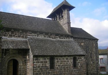
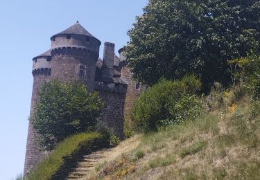
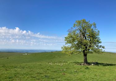
Très belle randonnée beaucoup de difficultés,faites sous un soleil de plomb,mais avec les nombreuses parties boisés toujours agréable


Trails nearby

Trail On foot Saint-Cirgues-de-Jordanne - Le Chaumeil - Photo
On foot
PRO

On foot

Easy
Saint-Cirgues-de-Jordanne, Auvergne-Rhône-Alpes, Cantal, France
8.2 km | 13.3 km-effort
3h 0min
Yes
Trail Hybrid bike Mandailles-Saint-Julien - Tournemire  - Photo
Hybrid bike
nadd73

Hybrid bike

Medium
Mandailles-Saint-Julien, Auvergne-Rhône-Alpes, Cantal, France
39 km | 50 km-effort
3h 2min
No
Trail Walking Lascelle - Arbre de quenouille, rocher saint curial, col de berganti - Photo
Walking
impradine

Walking

Easy
Lascelle, Auvergne-Rhône-Alpes, Cantal, France
12.8 km | 19 km-effort
3h 37min
Yes
Trail Walking Laroquevieille - col du bruel  - Photo
Walking
rene15000

Walking

Medium
Laroquevieille, Auvergne-Rhône-Alpes, Cantal, France
10.1 km | 15.2 km-effort
2h 38min
Yes
Trail Walking Saint-Cirgues-de-Jordanne - La Flandonnière - Photo
Walking
alexecolo15

Walking

Easy
(1)
Saint-Cirgues-de-Jordanne, Auvergne-Rhône-Alpes, Cantal, France
7.6 km | 11.3 km-effort
2h 19min
Yes
Trail Running Vic-sur-Cère - vic sur cere - Photo
Running
lbahier

Running

Medium
Vic-sur-Cère, Auvergne-Rhône-Alpes, Cantal, France
11.7 km | 18.9 km-effort
1h 37min
Yes
Trail Walking Vic-sur-Cère - 06/1 avil 2023  - Photo
Walking
habby

Walking

Very easy
Vic-sur-Cère, Auvergne-Rhône-Alpes, Cantal, France
5.7 km | 9.7 km-effort
39min
Yes
Trail Walking Saint-Cirgues-de-Jordanne - Saint cirgues-le Chaumeil-Laprade - Photo
Walking
danou56

Walking

Medium
Saint-Cirgues-de-Jordanne, Auvergne-Rhône-Alpes, Cantal, France
12.5 km | 19.3 km-effort
5h 8min
Yes
Trail Walking Saint-Cirgues-de-Jordanne - Saint cirgues-le Chaumeil-Laprade - Photo
Walking
viam19

Walking

Medium
Saint-Cirgues-de-Jordanne, Auvergne-Rhône-Alpes, Cantal, France
12.5 km | 19.3 km-effort
5h 8min
Yes


Close
My subscriptions