Trail Walking Clermont-le-Fort - Clermont-le-fort Notre-Dame des Bois - Photo

Clermont-le-fort Notre-Dame des Bois

© OpenStreetMap contributors
Length
Length
11.2 km
Max alt
Max alt
285 m
Uphill gradient
Uphill gradient
261 m
Km-Effort
Km-Effort  
14.7 km
Min alt
Min alt
160 m
Downhill gradient
Downhill gradient
261 m
Boucle
Boucle
Yes
Creation date :
2016-08-01 00:00:00.0
Updated on :
2016-08-01 00:00:00.0

(1 Reviews)

Walking
Walking
3h07
Difficulty : Easy

Scan this QR Code to open this trail in the SityTrail application

FREE GPS app for hiking

Logo SityTrail SityTrail

IGN / Geographical institutes

Download SityTrail from the App Store Download SityTrail from Google Play

Logo SityTrail SityTrail World

The world is yours!

Download SityTrail from the App Store Download SityTrail from Google Play Download SityTrail on Huawei AppGallery

About

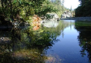
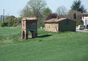
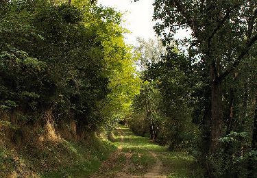
Trail Walking of 11.2 km to be discovered at Occitania, Haute-Garonne, Clermont-le-Fort. This trail is proposed by alain2306.

Elevation profile

Points of interest

Point of interest Clermont-le-Fort - Parking Clermont-le-Fort - Photo
alain2306
CLERMONT-LE-FORT 
Point of interest Clermont-le-Fort - Le Fort - Photo
alain2306
CLERMONT-LE-FORT 
Point of interest Clermont-le-Fort - La Roche - Photo
alain2306
CLERMONT-LE-FORT 
Point of interest Clermont-le-Fort - Rive d Aygue - Photo
alain2306
CLERMONT-LE-FORT 
Point of interest Clermont-le-Fort - Jourda - Photo
alain2306
CLERMONT-LE-FORT 
Point of interest Clermont-le-Fort - L Infernet - Photo
alain2306
CLERMONT-LE-FORT 
Point of interest Clermont-le-Fort - Notre-Dame des bois - Photo
alain2306
CLERMONT-LE-FORT 
Point of interest Clermont-le-Fort - Les Quatre Tables - Photo
alain2306
CLERMONT-LE-FORT 
Point of interest Aureville - Lambert - Photo
alain2306
AUREVILLE 
Point of interest Clermont-le-Fort - Les Tailladettes - Photo
alain2306
CLERMONT-LE-FORT 
Point of interest Clermont-le-Fort - Le Piteau - Photo
alain2306
CLERMONT-LE-FORT 
Point of interest Clermont-le-Fort - La Bregue - Photo
alain2306
CLERMONT-LE-FORT 
Point of interest Clermont-le-Fort - La Tcheline - Photo
alain2306
CLERMONT-LE-FORT 
Point of interest Clermont-le-Fort - Lou Camp Del Obit - Photo
alain2306
CLERMONT-LE-FORT 
Point of interest Clermont-le-Fort - Les Fraysses - Photo
alain2306
CLERMONT-LE-FORT 

Positioning

Country:
France
Region :
Occitania
Department/Province :
Haute-Garonne
Municipality :
Clermont-le-Fort
Location:
Unknown
Start:(UTM)
373170 ; 4812909 (31T) N.

Comments

Please log in to post a review or rate the element


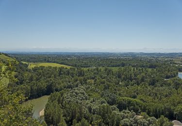
balade à faire par beau temps pour profiter du spectacle de la chaîne des Pyrénées et lorsque les champs sont cultivés.


Trails nearby

Trail Mountain bike Pins-Justaret - De Pins Justaret à Clermont Le Fort - Photo
Mountain bike
tracegps

Mountain bike

Medium
(1)
Pins-Justaret, Occitania, Haute-Garonne, France
30 km | 35 km-effort
2h 30min
Yes
Trail Mountain bike Aureville - Aureville à Goyrans - Photo
Mountain bike
tracegps

Mountain bike

Medium
(1)
Aureville, Occitania, Haute-Garonne, France
14.9 km | 19.4 km-effort
1h 0min
Yes
Trail Walking Aureville - Aureville à Goyrans - Photo
Walking
tracegps

Walking

Medium
(1)
Aureville, Occitania, Haute-Garonne, France
14.9 km | 19.4 km-effort
3h 0min
Yes
Trail On foot Clermont-le-Fort - Boucle de Notre-Dame des Bois - Photo
On foot
PRO

On foot

Easy
Clermont-le-Fort, Occitania, Haute-Garonne, France
10.9 km | 14.1 km-effort
3h 12min
Yes
Trail Walking Clermont-le-Fort - L'Ariège de Clermont Le Fort à Vénerque - Photo
Walking
tracegps

Walking

Medium
(2)
Clermont-le-Fort, Occitania, Haute-Garonne, France
9.2 km | 12.2 km-effort
2h 0min
Yes
Trail Mountain bike Pins-Justaret - Pins justaret - Photo
Mountain bike
seb31410

Mountain bike

Easy
(1)
Pins-Justaret, Occitania, Haute-Garonne, France
34 km | 40 km-effort
2h 49min
Yes
Trail Walking Espanès - Pigeonnier de Barèges - Espanès - Photo
Walking
tracegps

Walking

Medium
Espanès, Occitania, Haute-Garonne, France
6.7 km | 8.6 km-effort
2h 30min
Yes
Trail Walking Lacroix-Falgarde - Lacroix Falgarde - Goyrans - Photo
Walking
tracegps

Walking

Medium
Lacroix-Falgarde, Occitania, Haute-Garonne, France
8 km | 10 km-effort
2h 0min
Yes
Trail Walking Rebigue - Randonnée autour de Rebigue - Photo
Walking
tracegps

Walking

Medium
Rebigue, Occitania, Haute-Garonne, France
12.1 km | 15.8 km-effort
3h 15min
Yes


Close
My subscriptions