


Traversé Lac noir-Col de Gondran.

Dervalmarc
User
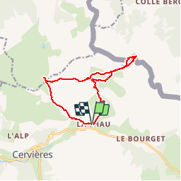

Length
13.7 km

Max alt
2432 m

Uphill gradient
629 m
Km-Effort
22 km

Min alt
1908 m

Downhill gradient
630 m
Boucle
Yes
Creation date :
2015-08-31 00:00:00.0
Updated on :
2015-08-31 00:00:00.0
5h01
Difficulty : Medium

FREE GPS app for hiking
 SityTrail
IGN / Geographical institutes
SityTrail Plus
The world is yours!
About
Trail Walking of 13.7 km to be discovered at Provence-Alpes-Côte d'Azur, Hautes-Alpes, Cervières. This trail is proposed by Dervalmarc.
Description
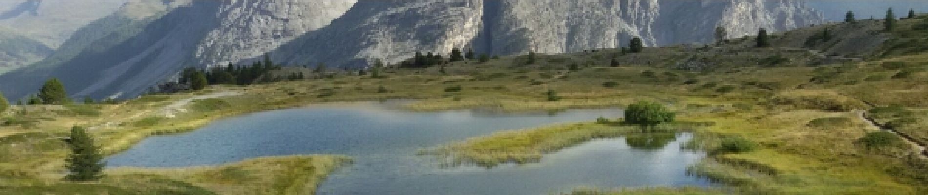
Randonnée très diversifié. Nombreux lacs, Col, sentier thématique au col du Gondran .Aucune difficultés particulières.
Photos


Positioning
Country:
France
Region :
Provence-Alpes-Côte d'Azur
Department/Province :
Hautes-Alpes
Municipality :
Cervières
Location:
Unknown
Start:(Dec)
Start:(UTM)
322328 ; 4972085 (32T) N.
Comments