


Sohier

vindju
User
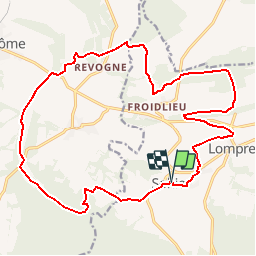

Length
20 km

Max alt
346 m

Uphill gradient
336 m
Km-Effort
25 km

Min alt
184 m

Downhill gradient
337 m
Boucle
Yes
Creation date :
2019-05-07 13:28:58.992
Updated on :
2019-05-07 13:28:59.096
5h19
Difficulty : Medium

FREE GPS app for hiking
 SityTrail
IGN / Geographical institutes
SityTrail Plus
The world is yours!
About
Trail Walking of 20 km to be discovered at Wallonia, Luxembourg, Wellin. This trail is proposed by vindju.
Positioning
Country:
Belgium
Region :
Wallonia
Department/Province :
Luxembourg
Municipality :
Wellin
Location:
Sohier
Start:(Dec)
Start:(UTM)
648146 ; 5548336 (31U) N.
Comments