


les Rives de l'Adour

embarbe
User
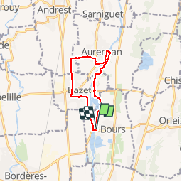

Length
10.1 km

Max alt
279 m

Uphill gradient
52 m
Km-Effort
10.8 km

Min alt
258 m

Downhill gradient
51 m
Boucle
Yes
Creation date :
2019-05-19 08:43:47.372
Updated on :
2019-05-19 08:43:47.482
2h19
Difficulty : Easy

FREE GPS app for hiking
 SityTrail
IGN / Geographical institutes
SityTrail Plus
The world is yours!
About
Trail Walking of 10.1 km to be discovered at Occitania, Hautespyrenees, Bours. This trail is proposed by embarbe.
Description
en boucle
Positioning
Country:
France
Region :
Occitania
Department/Province :
Hautespyrenees
Municipality :
Bours
Location:
Unknown
Start:(Dec)
Start:(UTM)
263469 ; 4795814 (31T) N.
Comments