


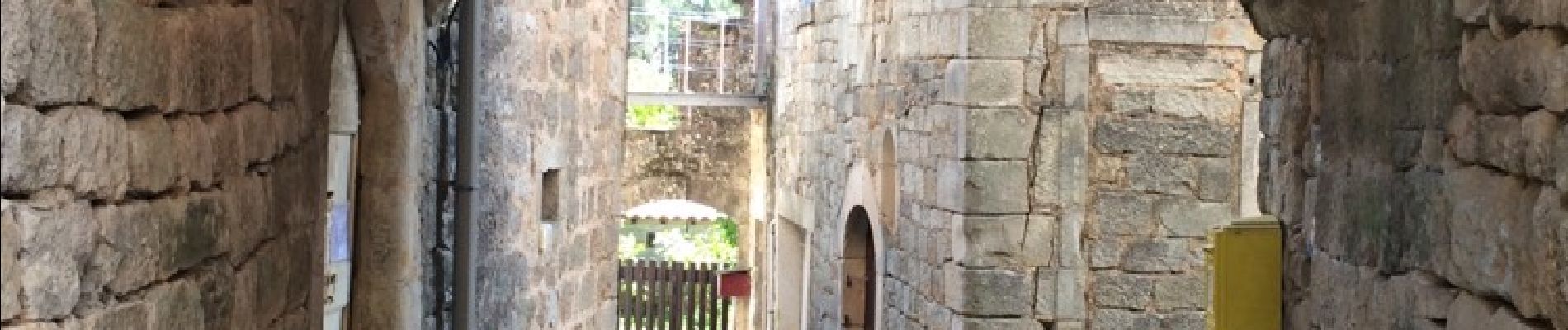
chambonas Champmajour

Michel07
User
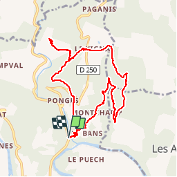

Length
10.7 km

Max alt
347 m

Uphill gradient
345 m
Km-Effort
15.3 km

Min alt
141 m

Downhill gradient
346 m
Boucle
Yes
Creation date :
2015-09-06 00:00:00.0
Updated on :
2015-09-06 00:00:00.0
2h54
Difficulty : Easy

FREE GPS app for hiking
 SityTrail
IGN / Geographical institutes
SityTrail Plus
The world is yours!
About
Trail Walking of 10.7 km to be discovered at Auvergne-Rhône-Alpes, Ardèche, Chambonas. This trail is proposed by Michel07.
Photos


Positioning
Country:
France
Region :
Auvergne-Rhône-Alpes
Department/Province :
Ardèche
Municipality :
Chambonas
Location:
Unknown
Start:(Dec)
Start:(UTM)
590281 ; 4919681 (31T) N.
Comments