


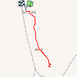
Tamazirt - Azib Ikkis

lhomme.ph
User GUIDE

Length
17.7 km

Max alt
2610 m

Uphill gradient
828 m
Km-Effort
29 km

Min alt
1893 m

Downhill gradient
830 m
Boucle
Yes
Creation date :
2015-09-16 00:00:00.0
Updated on :
2015-09-16 00:00:00.0
5h55
Difficulty : Medium

FREE GPS app for hiking
 SityTrail
IGN / Geographical institutes
SityTrail Plus
The world is yours!
About
Trail Walking of 17.7 km to be discovered at Béni Mellal-Khénifra, cercle d'Azilal, Tabant. This trail is proposed by lhomme.ph.
Positioning
Country:
Morocco
Region :
Béni Mellal-Khénifra
Department/Province :
cercle d'Azilal
Municipality :
Tabant
Location:
Unknown
Start:(Dec)
Start:(UTM)
737991 ; 3500291 (29R) N.
Comments