


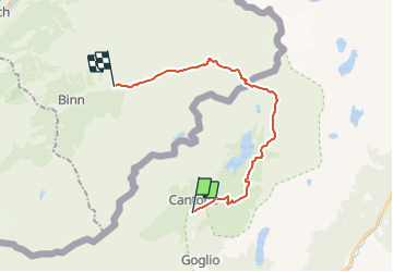
Crampiolo - Albrunpass (variante 2)

Allegro
User

Length
19.6 km

Max alt
2413 m

Uphill gradient
1006 m
Km-Effort
33 km

Min alt
1540 m

Downhill gradient
1095 m
Boucle
No
Creation date :
2014-12-10 00:00:00.0
Updated on :
2014-12-10 00:00:00.0
8h08
Difficulty : Unknown

FREE GPS app for hiking
 SityTrail
IGN / Geographical institutes
SityTrail Plus
The world is yours!
About
Trail Walking of 19.6 km to be discovered at Piemont, Verbano-Cusio-Ossola, Baceno. This trail is proposed by Allegro.
Positioning
Country:
Italy
Region :
Piemont
Department/Province :
Verbano-Cusio-Ossola
Municipality :
Baceno
Location:
Unknown
Start:(Dec)
Start:(UTM)
443083 ; 5129353 (32T) N.
Comments