


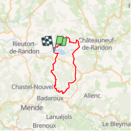
Circuit charpal-pelouse

Quentin48
User

Length
38 km

Max alt
1429 m

Uphill gradient
862 m
Km-Effort
50 km

Min alt
937 m

Downhill gradient
871 m
Boucle
Yes
Creation date :
2016-03-09 00:00:00.0
Updated on :
2016-03-09 00:00:00.0
2h54
Difficulty : Medium

FREE GPS app for hiking
 SityTrail
IGN / Geographical institutes
SityTrail Plus
The world is yours!
About
Trail Mountain bike of 38 km to be discovered at Occitania, Lozère, Monts-de-Randon. This trail is proposed by Quentin48.
Description
Passage difficile au dessus de Pelgeires
Positioning
Country:
France
Region :
Occitania
Department/Province :
Lozère
Municipality :
Monts-de-Randon
Location:
Rieutort-de-Randon
Start:(Dec)
Start:(UTM)
544451 ; 4941287 (31T) N.
Comments