Trail Walking Feldberg - Hochschwarzwald - Photo
 michelek
michelek

User

© OpenStreetMap contributors
Length
Length
25 km
Max alt
Max alt
1375 m
Uphill gradient
Uphill gradient
973 m
Km-Effort
Km-Effort  
38 km
Min alt
Min alt
882 m
Downhill gradient
Downhill gradient
976 m
Boucle
Boucle
Yes
Creation date :
2018-11-10 10:09:04.086
Updated on :
2018-11-10 10:09:04.151

(0 Reviews)

Walking
Walking
7h58
Difficulty : Difficult

Scan this QR Code to open this trail in the SityTrail application

FREE GPS app for hiking

Logo SityTrail SityTrail

IGN / Geographical institutes

Download SityTrail from the App Store Download SityTrail from Google Play

Logo SityTrail SityTrail Plus

The world is yours!

Download SityTrail from the App Store Download SityTrail from Google Play Download SityTrail on Huawei AppGallery

About

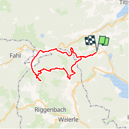
Trail Walking of 25 km to be discovered at Baden-Württemberg, Landkreis Breisgau-Hochschwarzwald, Feldberg. This trail is proposed by michelek.

Description

Belle et longue rando dans la Haute Forêt Noire au départ de Sommerberg. Passage par le joli village de Mensenschwande et sa cascade, ravitaillement à la Krunkelbachhütte puis retour par la station de Feldberg.

Elevation profile

Positioning

Country:
Germany
Region :
Baden-Württemberg
Department/Province :
Landkreis Breisgau-Hochschwarzwald
Municipality :
Feldberg
Location:
Altglashütten
Start:(UTM)
433257 ; 5300600 (32T) N.


Close
My subscriptions