


Vallon Sourn et Baumes

francisdean
User

Length
11.1 km

Max alt
356 m

Uphill gradient
294 m
Km-Effort
15 km

Min alt
166 m

Downhill gradient
290 m
Boucle
Yes
Creation date :
2015-09-23 00:00:00.0
Updated on :
2015-09-23 00:00:00.0
5h00
Difficulty : Easy

FREE GPS app for hiking
 SityTrail
IGN / Geographical institutes
SityTrail Plus
The world is yours!
About
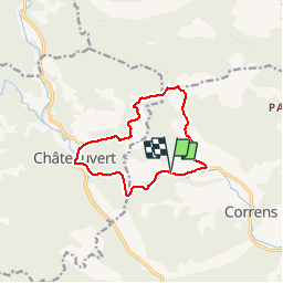
Trail Walking of 11.1 km to be discovered at Provence-Alpes-Côte d'Azur, Var, Correns. This trail is proposed by francisdean.
Positioning
Country:
France
Region :
Provence-Alpes-Côte d'Azur
Department/Province :
Var
Municipality :
Correns
Location:
Unknown
Start:(Dec)
Start:(UTM)
261960 ; 4820149 (32T) N.
Comments
une partie du circuit (N102 Chanche) est inaccessible. Route barrée avec affichage "Voie privée non accessible au public"