


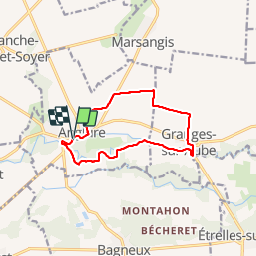
Au fil de l'Aube

rochedaniel
User

Length
10.5 km

Max alt
93 m

Uphill gradient
51 m
Km-Effort
11.2 km

Min alt
69 m

Downhill gradient
51 m
Boucle
Yes
Creation date :
2015-11-11 00:00:00.0
Updated on :
2015-11-11 00:00:00.0
2h07
Difficulty : Very easy

FREE GPS app for hiking
 SityTrail
IGN / Geographical institutes
SityTrail Plus
The world is yours!
About
Trail Walking of 10.5 km to be discovered at Grand Est, Marne, Anglure. This trail is proposed by rochedaniel.
Description
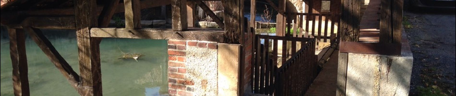
Anglure, barrage de Belle-Assise, Granges et retour vers Anglure par les champs
Photos


Positioning
Country:
France
Region :
Grand Est
Department/Province :
Marne
Municipality :
Anglure
Location:
Unknown
Start:(Dec)
Start:(UTM)
559879 ; 5381399 (31U) N.
Comments