


smokkelroute

julesverhoeven
User
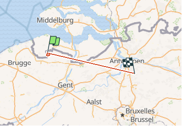

Length
75 km

Max alt
33 m

Uphill gradient
373 m
Km-Effort
80 km

Min alt
-10 m

Downhill gradient
360 m
Boucle
No
Creation date :
2014-12-10 00:00:00.0
Updated on :
2014-12-10 00:00:00.0
--
Difficulty : Unknown

FREE GPS app for hiking
 SityTrail
IGN / Geographical institutes
SityTrail Plus
The world is yours!
About
Trail Walking of 75 km to be discovered at Flanders, East Flanders, Sint-Laureins. This trail is proposed by julesverhoeven.
Positioning
Country:
Belgium
Region :
Flanders
Department/Province :
East Flanders
Municipality :
Sint-Laureins
Location:
Sint-Margriete
Start:(Dec)
Start:(UTM)
537417 ; 5680844 (31U) N.
Comments