


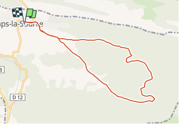
CAMPS LA SOURCE LES CHATAIGNIERS - 10KM

jpb83
User

Length
10.5 km

Max alt
420 m

Uphill gradient
279 m
Km-Effort
14.2 km

Min alt
272 m

Downhill gradient
280 m
Boucle
Yes
Creation date :
2016-08-07 00:00:00.0
Updated on :
2016-08-07 00:00:00.0
1h10
Difficulty : Medium

FREE GPS app for hiking
 SityTrail
IGN / Geographical institutes
SityTrail Plus
The world is yours!
About
Trail Running of 10.5 km to be discovered at Provence-Alpes-Côte d'Azur, Var, Camps-la-Source. This trail is proposed by jpb83.
Positioning
Country:
France
Region :
Provence-Alpes-Côte d'Azur
Department/Province :
Var
Municipality :
Camps-la-Source
Location:
Unknown
Start:(Dec)
Start:(UTM)
265062 ; 4807640 (32T) N.
Comments