


Boeuvres

chasle
User

Length
19.5 km

Max alt
98 m

Uphill gradient
392 m
Km-Effort
25 km

Min alt
4 m

Downhill gradient
401 m
Boucle
Yes
Creation date :
2016-05-07 00:00:00.0
Updated on :
2016-05-07 00:00:00.0
5h19
Difficulty : Easy

FREE GPS app for hiking
 SityTrail
IGN / Geographical institutes
SityTrail Plus
The world is yours!
About
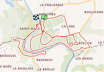
Trail Walking of 19.5 km to be discovered at Brittany, Ille-et-Vilaine, Guipry-Messac. This trail is proposed by chasle.
Positioning
Country:
France
Region :
Brittany
Department/Province :
Ille-et-Vilaine
Municipality :
Guipry-Messac
Location:
Messac
Start:(Dec)
Start:(UTM)
587080 ; 5291977 (30T) N.
Comments