Trail Walking Täsch - Täsch, Ober Sattla - Photo

Täsch, Ober Sattla

 rpf
rpf

User

© OpenStreetMap contributors
Length
Length
9 km
Max alt
Max alt
2693 m
Uphill gradient
Uphill gradient
644 m
Km-Effort
Km-Effort  
17.6 km
Min alt
Min alt
2134 m
Downhill gradient
Downhill gradient
642 m
Boucle
Boucle
Yes
Creation date :
2014-12-10 00:00:00.0
Updated on :
2014-12-10 00:00:00.0

(0 Reviews)

Walking
Walking
5h30
Difficulty : Unknown

Scan this QR Code to open this trail in the SityTrail application

FREE GPS app for hiking

Logo SityTrail SityTrail

IGN / Geographical institutes

Download SityTrail from the App Store Download SityTrail from Google Play

Logo SityTrail SityTrail Plus

The world is yours!

Download SityTrail from the App Store Download SityTrail from Google Play Download SityTrail on Huawei AppGallery

About

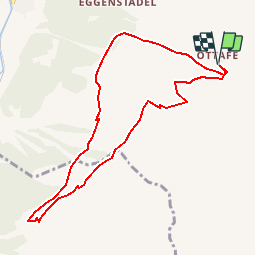
Trail Walking of 9 km to be discovered at Valais/Wallis, Visp, Täsch. This trail is proposed by rpf.

Description

Une randonnée classique, mais fascinante sur le balcon des 4000 ! Face au Cervin, à l''aller, après le passage d''Ober Sattla, face au Weisshorn au retour, sur l''Europaweg, sans oublier les magnifiques vues sur la Dent d''Hérens, l''Ober Gabelhorn, le Zinalrothorn, et le Täschhorn.

Départ à Täschalp accessible en voiture, montée directe à Ober Sattla, descente face au Cervin qui trône au fond de la vallée.
Retour sur un tronçon de l''Europaweg.

Une balade de  " www.toprando.ch "

Elevation profile

Positioning

Country:
Switzerland
Region :
Valais/Wallis
Department/Province :
Visp
Municipality :
Täsch
Location:
Unknown
Start:(UTM)
408041 ; 5101198 (32T) N.


Close
My subscriptions