Trail Walking Conthey - Derborence, Pas de Cheville - Photo

Derborence, Pas de Cheville

 rpf
rpf

User

© OpenStreetMap contributors
Length
Length
8.8 km
Max alt
Max alt
2092 m
Uphill gradient
Uphill gradient
701 m
Km-Effort
Km-Effort  
18.1 km
Min alt
Min alt
1451 m
Downhill gradient
Downhill gradient
701 m
Boucle
Boucle
Yes
Creation date :
2014-12-10 00:00:00.0
Updated on :
2014-12-10 00:00:00.0

(0 Reviews)

Walking
Walking
5h30
Difficulty : Unknown

Scan this QR Code to open this trail in the SityTrail application

FREE GPS app for hiking

Logo SityTrail SityTrail

IGN / Geographical institutes

Download SityTrail from the App Store Download SityTrail from Google Play

Logo SityTrail SityTrail World

The world is yours!

Download SityTrail from the App Store Download SityTrail from Google Play Download SityTrail on Huawei AppGallery

About

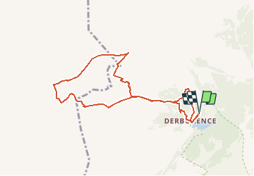
Trail Walking of 8.8 km to be discovered at Valais/Wallis, Conthey, Conthey. This trail is proposed by rpf.

Description

Une balade en partie hors-sentiers sur la vaste étendue du Pas de Cheville, entre petites collines et dépressions, dans un magnifique panorama que le sentier "officiel" vers Anzeindaz ne permet pas de découvrir.

Avec un minimum d''habileté, la promenade ne présente pas de grande difficulté, mais elle ne suit pas toujours des sentiers balisés et demande un minimum de sens de l''orientation.
Le sentier qui remonte les Teppes Vertes, au fond de la combe à droite après le Grenier, n''est plus très visible. Il a été abandonné au profit d''un nouveau chemin aménagé sur le fond gauche de la combe, qui sort aux Filasses, mais qui se trouve très vite à l''ombre et risque d''être glacé ou enneigé.

Départ au hameau de Derborence.

Une balade de  " www.toprando.ch "

Elevation profile

Positioning

Country:
Switzerland
Region :
Valais/Wallis
Department/Province :
Conthey
Municipality :
Conthey
Location:
Unknown
Start:(UTM)
362584 ; 5126824 (32T) N.

Trails nearby

Trail Walking Savièse - st_koreatv08_07 - Photo
Walking
GUIDE+

Walking

Very easy
Savièse, Valais/Wallis, Sion, Switzerland
4.5 km | 8.9 km-effort
1h 37min
No
Trail Walking Conthey - huetten_02 - Photo
Walking
GUIDE+

Walking

Very easy
Conthey, Valais/Wallis, Conthey, Switzerland
50 km | 102 km-effort
16h 52min
Yes
Trail Walking Conthey - Trajet du 29.10.21 - Photo
Walking
Leemans

Walking

Very difficult
Conthey, Valais/Wallis, Conthey, Switzerland
19.5 km | 38 km-effort
8h 42min
Yes
Trail Walking Conthey - Lac Forcla - Photo
Walking
jipi2

Walking

Medium
Conthey, Valais/Wallis, Conthey, Switzerland
16.8 km | 33 km-effort
8h 1min
Yes
Trail Walking Conthey - Martigny-Kandersteg (3) Hotel du Sanetsch - Photo
Walking
rpf

Walking

Very easy
Conthey, Valais/Wallis, Conthey, Switzerland
14.8 km | 28 km-effort
6h 45min
No
Trail Walking Ardon - Ardon, Einzon - Photo
Walking
rpf

Walking

Very easy
Ardon, Valais/Wallis, Conthey, Switzerland
8.1 km | 21 km-effort
6h 30min
Yes
Trail Walking Conthey - Tour des Muverans - Photo
Walking
rpf

Walking

Very easy
Conthey, Valais/Wallis, Conthey, Switzerland
48 km | 101 km-effort
23h 45min
Yes
Trail Walking Conthey - Derborence, Val Derbon - Photo
Walking
rpf

Walking

Very easy
Conthey, Valais/Wallis, Conthey, Switzerland
8.9 km | 17.6 km-effort
4h 30min
Yes
Trail Walking Conthey - Derborence, Chaux de Mié - Photo
Walking
rpf

Walking

Very easy
Conthey, Valais/Wallis, Conthey, Switzerland
5.7 km | 14.7 km-effort
3h 30min
Yes


Close
My subscriptions