


canche variante

aubr
User
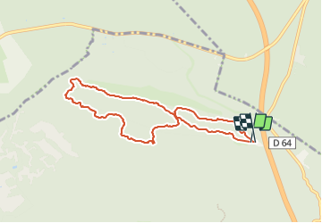

Length
7.8 km

Max alt
127 m

Uphill gradient
119 m
Km-Effort
9.4 km

Min alt
75 m

Downhill gradient
120 m
Boucle
Yes
Creation date :
2015-11-05 00:00:00.0
Updated on :
2024-01-08 17:27:01.159
2h08
Difficulty : Medium

FREE GPS app for hiking
 SityTrail
IGN / Geographical institutes
SityTrail Plus
The world is yours!
About
Trail Walking of 7.8 km to be discovered at Ile-de-France, Seine-et-Marne, Noisy-sur-École. This trail is proposed by aubr.
Description
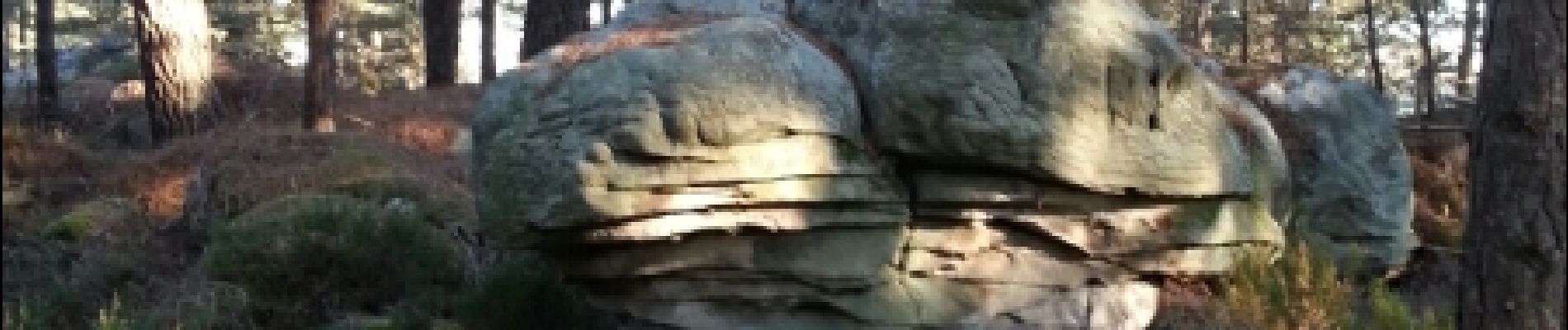
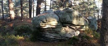
Boucle au départ du parking de la Canche aux Merciers sur la D64 entre Arbonne la foret et Achères la Foret.
Photos


Positioning
Country:
France
Region :
Ile-de-France
Department/Province :
Seine-et-Marne
Municipality :
Noisy-sur-École
Location:
Unknown
Start:(Dec)
Start:(UTM)
466841 ; 5359800 (31U) N.
Comments