


Telethon 2015 - Rando Pedestre

norbertmarteau
User

Length
6.2 km

Max alt
486 m

Uphill gradient
104 m
Km-Effort
7.6 km

Min alt
435 m

Downhill gradient
104 m
Boucle
Yes
Creation date :
2015-11-08 00:00:00.0
Updated on :
2015-11-08 00:00:00.0
1h38
Difficulty : Medium

FREE GPS app for hiking
 SityTrail
IGN / Geographical institutes
SityTrail Plus
The world is yours!
About
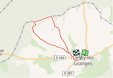
Trail Walking of 6.2 km to be discovered at Bourgogne-Franche-Comté, Doubs, Naisey-les-Granges. This trail is proposed by norbertmarteau.
Description
Nouveau parcours sur Naisey les Granges
Positioning
Country:
France
Region :
Bourgogne-Franche-Comté
Department/Province :
Doubs
Municipality :
Naisey-les-Granges
Location:
Unknown
Start:(Dec)
Start:(UTM)
290708 ; 5232455 (32T) N.
Comments