


Tour du Grand Replomb

raymondfn
User

Length
9.5 km

Max alt
2415 m

Uphill gradient
665 m
Km-Effort
20 km

Min alt
1305 m

Downhill gradient
1302 m
Boucle
No
Creation date :
2015-11-09 00:00:00.0
Updated on :
2015-11-09 00:00:00.0
3h44
Difficulty : Medium

FREE GPS app for hiking
 SityTrail
IGN / Geographical institutes
SityTrail Plus
The world is yours!
About
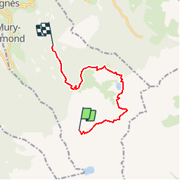
Trail Walking of 9.5 km to be discovered at Auvergne-Rhône-Alpes, Isère, Sainte-Agnès. This trail is proposed by raymondfn.
Positioning
Country:
France
Region :
Auvergne-Rhône-Alpes
Department/Province :
Isère
Municipality :
Sainte-Agnès
Location:
Unknown
Start:(Dec)
Start:(UTM)
733110 ; 5008615 (31T) N.
Comments