


Dourgne 1

josy31
User
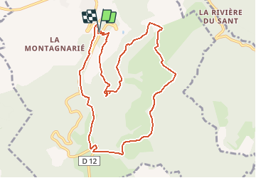

Length
11.4 km

Max alt
715 m

Uphill gradient
522 m
Km-Effort
18.3 km

Min alt
338 m

Downhill gradient
518 m
Boucle
Yes
Creation date :
2015-11-10 00:00:00.0
Updated on :
2015-11-10 00:00:00.0
3h00
Difficulty : Unknown

FREE GPS app for hiking
 SityTrail
IGN / Geographical institutes
SityTrail Plus
The world is yours!
About
Trail Other activity of 11.4 km to be discovered at Occitania, Tarn, Dourgne. This trail is proposed by josy31.
Positioning
Country:
France
Region :
Occitania
Department/Province :
Tarn
Municipality :
Dourgne
Location:
Unknown
Start:(Dec)
Start:(UTM)
430574 ; 4814182 (31T) N.
Comments