


Restinclières-Beaulieu

JEANJOSY
User
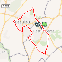

Length
8.7 km

Max alt
106 m

Uphill gradient
104 m
Km-Effort
10.1 km

Min alt
62 m

Downhill gradient
104 m
Boucle
Yes
Creation date :
2015-11-14 00:00:00.0
Updated on :
2015-11-14 00:00:00.0
2h20
Difficulty : Very easy

FREE GPS app for hiking
 SityTrail
IGN / Geographical institutes
SityTrail Plus
The world is yours!
About
Trail Walking of 8.7 km to be discovered at Occitania, Hérault, Restinclières. This trail is proposed by JEANJOSY.
Positioning
Country:
France
Region :
Occitania
Department/Province :
Hérault
Municipality :
Restinclières
Location:
Unknown
Start:(Dec)
Start:(UTM)
583416 ; 4841792 (31T) N.
Comments
Énormément de routes goudronnées