


mullerthal

lamortgregory
User
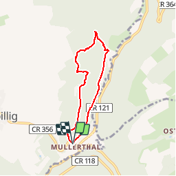

Length
5.4 km

Max alt
326 m

Uphill gradient
162 m
Km-Effort
7.5 km

Min alt
216 m

Downhill gradient
160 m
Boucle
Yes
Creation date :
2015-11-19 00:00:00.0
Updated on :
2015-11-19 00:00:00.0
1h40
Difficulty : Medium

FREE GPS app for hiking
 SityTrail
IGN / Geographical institutes
SityTrail Plus
The world is yours!
About
Trail Walking of 5.4 km to be discovered at Unknown, Canton Echternach, Waldbillig. This trail is proposed by lamortgregory.
Description
bois sentier par le fond et le haut des roche.
Positioning
Country:
Luxembourg
Region :
Unknown
Department/Province :
Canton Echternach
Municipality :
Waldbillig
Location:
Unknown
Start:(Dec)
Start:(UTM)
306136 ; 5518854 (32U) N.
Comments