


Lincel

mhetpierre
User

Length
12.3 km

Max alt
615 m

Uphill gradient
296 m
Km-Effort
16.2 km

Min alt
453 m

Downhill gradient
293 m
Boucle
Yes
Creation date :
2018-08-18 15:30:18.285
Updated on :
2018-08-18 15:30:18.285
4h04
Difficulty : Very easy

FREE GPS app for hiking
 SityTrail
IGN / Geographical institutes
SityTrail Plus
The world is yours!
About
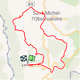
Trail Walking of 12.3 km to be discovered at Provence-Alpes-Côte d'Azur, Alpes-de-Haute-Provence, Saint-Michel-l'Observatoire. This trail is proposed by mhetpierre.
Positioning
Country:
France
Region :
Provence-Alpes-Côte d'Azur
Department/Province :
Alpes-de-Haute-Provence
Municipality :
Saint-Michel-l'Observatoire
Location:
Lincel
Start:(Dec)
Start:(UTM)
717402 ; 4863196 (31T) N.
Comments