


Les Arcs. Le sommet des Terrriers 1

Sugg
User
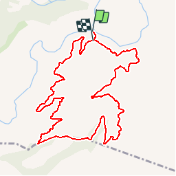

Length
12.8 km

Max alt
335 m

Uphill gradient
371 m
Km-Effort
17.6 km

Min alt
37 m

Downhill gradient
351 m
Boucle
Yes
Creation date :
2019-03-22 16:59:35.568
Updated on :
2019-03-22 16:59:35.613
4h37
Difficulty : Medium

FREE GPS app for hiking
 SityTrail
IGN / Geographical institutes
SityTrail Plus
The world is yours!
About
Trail Walking of 12.8 km to be discovered at Provence-Alpes-Côte d'Azur, Var, Les Arcs-sur-Argens. This trail is proposed by Sugg.
Description
Forêt communal des Arcs sur Argens.
Petit parcours, multiples variantes possibles !
Positioning
Country:
France
Region :
Provence-Alpes-Côte d'Azur
Department/Province :
Var
Municipality :
Les Arcs-sur-Argens
Location:
Unknown
Start:(Dec)
Start:(UTM)
298503 ; 4811763 (32T) N.
Comments