


La Combe de Bain à Chatillon

collot
User

Length
11.2 km

Max alt
1173 m

Uphill gradient
609 m
Km-Effort
19.3 km

Min alt
573 m

Downhill gradient
608 m
Boucle
Yes
Creation date :
2016-03-09 00:00:00.0
Updated on :
2023-02-27 11:05:34.624
4h11
Difficulty : Medium

FREE GPS app for hiking
 SityTrail
IGN / Geographical institutes
SityTrail Plus
The world is yours!
About
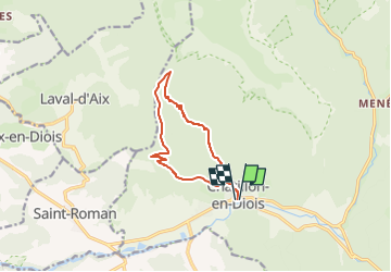
Trail Walking of 11.2 km to be discovered at Auvergne-Rhône-Alpes, Drôme, Châtillon-en-Diois. This trail is proposed by collot.
Description
Randonnée agréable et bien signalée.
Positioning
Country:
France
Region :
Auvergne-Rhône-Alpes
Department/Province :
Drôme
Municipality :
Châtillon-en-Diois
Location:
Châtillon-en-Diois
Start:(Dec)
Start:(UTM)
696920 ; 4951988 (31T) N.
Comments