


Les Arcs-Forêt des Apiés rando

Sugg
User
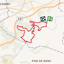

Length
16.9 km

Max alt
176 m

Uphill gradient
377 m
Km-Effort
22 km

Min alt
29 m

Downhill gradient
379 m
Boucle
Yes
Creation date :
2019-03-22 16:59:32.059
Updated on :
2019-03-22 16:59:32.246
4h56
Difficulty : Medium

FREE GPS app for hiking
 SityTrail
IGN / Geographical institutes
SityTrail Plus
The world is yours!
About
Trail Walking of 16.9 km to be discovered at Provence-Alpes-Côte d'Azur, Var, Les Arcs-sur-Argens. This trail is proposed by Sugg.
Description
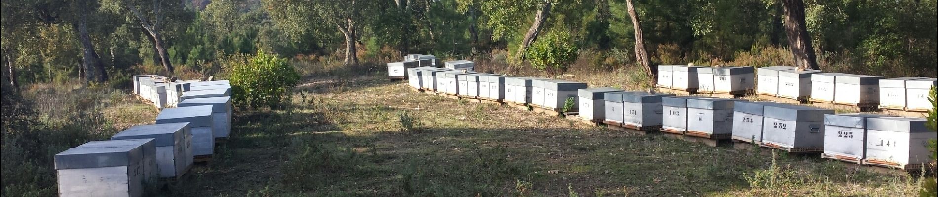
Rando du 16 décembre 2015
Dernière de l'année.
Photos


Positioning
Country:
France
Region :
Provence-Alpes-Côte d'Azur
Department/Province :
Var
Municipality :
Les Arcs-sur-Argens
Location:
Unknown
Start:(Dec)
Start:(UTM)
298524 ; 4812078 (32T) N.
Comments