


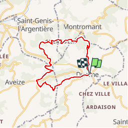
Duerne et l'aqueduc de la Brévenne

daniellebou
User

Length
13.5 km

Max alt
929 m

Uphill gradient
530 m
Km-Effort
21 km

Min alt
596 m

Downhill gradient
531 m
Boucle
Yes
Creation date :
2015-12-19 00:00:00.0
Updated on :
2015-12-19 00:00:00.0
4h17
Difficulty : Medium

FREE GPS app for hiking
 SityTrail
IGN / Geographical institutes
SityTrail Plus
The world is yours!
About
Trail Walking of 13.5 km to be discovered at Auvergne-Rhône-Alpes, Rhône, Duerne. This trail is proposed by daniellebou.
Description
Randonnée provenant de Visio Rando
Positioning
Country:
France
Region :
Auvergne-Rhône-Alpes
Department/Province :
Rhône
Municipality :
Duerne
Location:
Unknown
Start:(Dec)
Start:(UTM)
619142 ; 5060195 (31T) N.
Comments