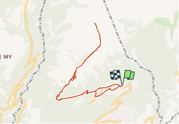
Trail Walking Savièse - Prabé - Photo
 jipi2
jipi2

User

© OpenStreetMap contributors
Length
Length
9.8 km
Max alt
Max alt
2128 m
Uphill gradient
Uphill gradient
804 m
Km-Effort
Km-Effort  
21 km
Min alt
Min alt
1315 m
Downhill gradient
Downhill gradient
804 m
Boucle
Boucle
Yes
Creation date :
2015-12-28 00:00:00.0
Updated on :
2015-12-28 00:00:00.0

(0 Reviews)

Walking
Walking
4h04
Difficulty : Easy

Scan this QR Code to open this trail in the SityTrail application

FREE GPS app for hiking

Logo SityTrail SityTrail

IGN / Geographical institutes

Download SityTrail from the App Store Download SityTrail from Google Play

Logo SityTrail SityTrail Plus

The world is yours!

Download SityTrail from the App Store Download SityTrail from Google Play Download SityTrail on Huawei AppGallery

About

Trail Walking of 9.8 km to be discovered at Valais/Wallis, Sion, Savièse. This trail is proposed by jipi2.

Elevation profile

Points of interest

Point of interest Savièse -  - Photo
jipi2
SAVIÈSE 
Point of interest Savièse -  - Photo
jipi2
SAVIÈSE 
Point of interest Savièse - Cabane privée - Photo
jipi2
SAVIÈSE 

Positioning

Country:
Switzerland
Region :
Valais/Wallis
Department/Province :
Sion
Municipality :
Savièse
Location:
Unknown
Start:(UTM)
373437 ; 5125782 (32T) N.


Close
My subscriptions