


Mattmark

jipi2
User
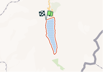

Length
7.9 km

Max alt
2266 m

Uphill gradient
181 m
Km-Effort
10.3 km

Min alt
2175 m

Downhill gradient
178 m
Boucle
Yes
Creation date :
2015-12-28 00:00:00.0
Updated on :
2015-12-28 00:00:00.0
2h41
Difficulty : Very easy

FREE GPS app for hiking
 SityTrail
IGN / Geographical institutes
SityTrail Plus
The world is yours!
About
Trail Walking of 7.9 km to be discovered at Valais/Wallis, Visp, Saas-Almagell. This trail is proposed by jipi2.


Positioning
Country:
Switzerland
Region :
Valais/Wallis
Department/Province :
Visp
Municipality :
Saas-Almagell
Location:
Unknown
Start:(Dec)
Start:(UTM)
419100 ; 5099906 (32T) N.
Comments