


Cervières Sommet des Anges

ARPF
User
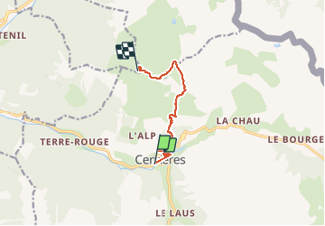

Length
7.6 km

Max alt
2449 m

Uphill gradient
852 m
Km-Effort
16.2 km

Min alt
1601 m

Downhill gradient
18 m
Boucle
No
Creation date :
2016-01-05 00:00:00.0
Updated on :
2016-01-05 00:00:00.0
4h00
Difficulty : Difficult

FREE GPS app for hiking
 SityTrail
IGN / Geographical institutes
SityTrail Plus
The world is yours!
About
Trail Snowshoes of 7.6 km to be discovered at Provence-Alpes-Côte d'Azur, Hautes-Alpes, Cervières. This trail is proposed by ARPF.
Description
Reco à faire
Positioning
Country:
France
Region :
Provence-Alpes-Côte d'Azur
Department/Province :
Hautes-Alpes
Municipality :
Cervières
Location:
Unknown
Start:(Dec)
Start:(UTM)
319849 ; 4970886 (32T) N.
Comments