


Vers Sommet des Anges

ARPF
User
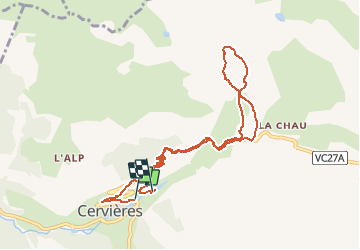

Length
10.1 km

Max alt
2149 m

Uphill gradient
589 m
Km-Effort
17.9 km

Min alt
1631 m

Downhill gradient
570 m
Boucle
No
Creation date :
2016-01-05 00:00:00.0
Updated on :
2016-01-05 00:00:00.0
5m
Difficulty : Medium

FREE GPS app for hiking
 SityTrail
IGN / Geographical institutes
SityTrail Plus
The world is yours!
About
Trail Snowshoes of 10.1 km to be discovered at Provence-Alpes-Côte d'Azur, Hautes-Alpes, Cervières. This trail is proposed by ARPF.
Positioning
Country:
France
Region :
Provence-Alpes-Côte d'Azur
Department/Province :
Hautes-Alpes
Municipality :
Cervières
Location:
Unknown
Start:(Dec)
Start:(UTM)
320352 ; 4971155 (32T) N.
Comments