


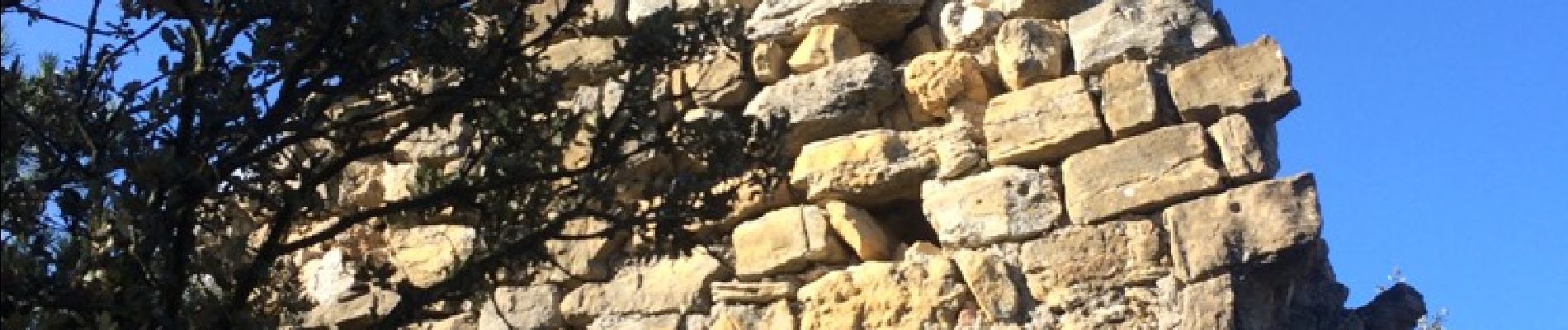
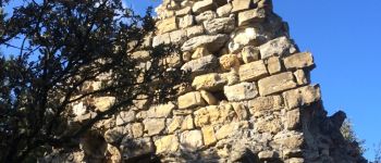
ruines derboux

mapomme
User
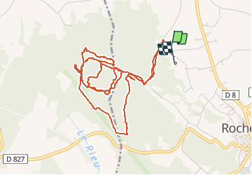

Length
7.1 km

Max alt
192 m

Uphill gradient
181 m
Km-Effort
9.5 km

Min alt
120 m

Downhill gradient
183 m
Boucle
Yes
Creation date :
2016-01-17 00:00:00.0
Updated on :
2016-01-17 00:00:00.0
1h31
Difficulty : Medium

FREE GPS app for hiking
 SityTrail
IGN / Geographical institutes
SityTrail Plus
The world is yours!
About
Trail Mountain bike of 7.1 km to be discovered at Auvergne-Rhône-Alpes, Drôme, Rochegude. This trail is proposed by mapomme.
Description
Bcp de beaux singles techniques. Qqs portages pour les petits mollets. A améliorer
Photos


Positioning
Country:
France
Region :
Auvergne-Rhône-Alpes
Department/Province :
Drôme
Municipality :
Rochegude
Location:
Unknown
Start:(Dec)
Start:(UTM)
645264 ; 4901844 (31T) N.
Comments